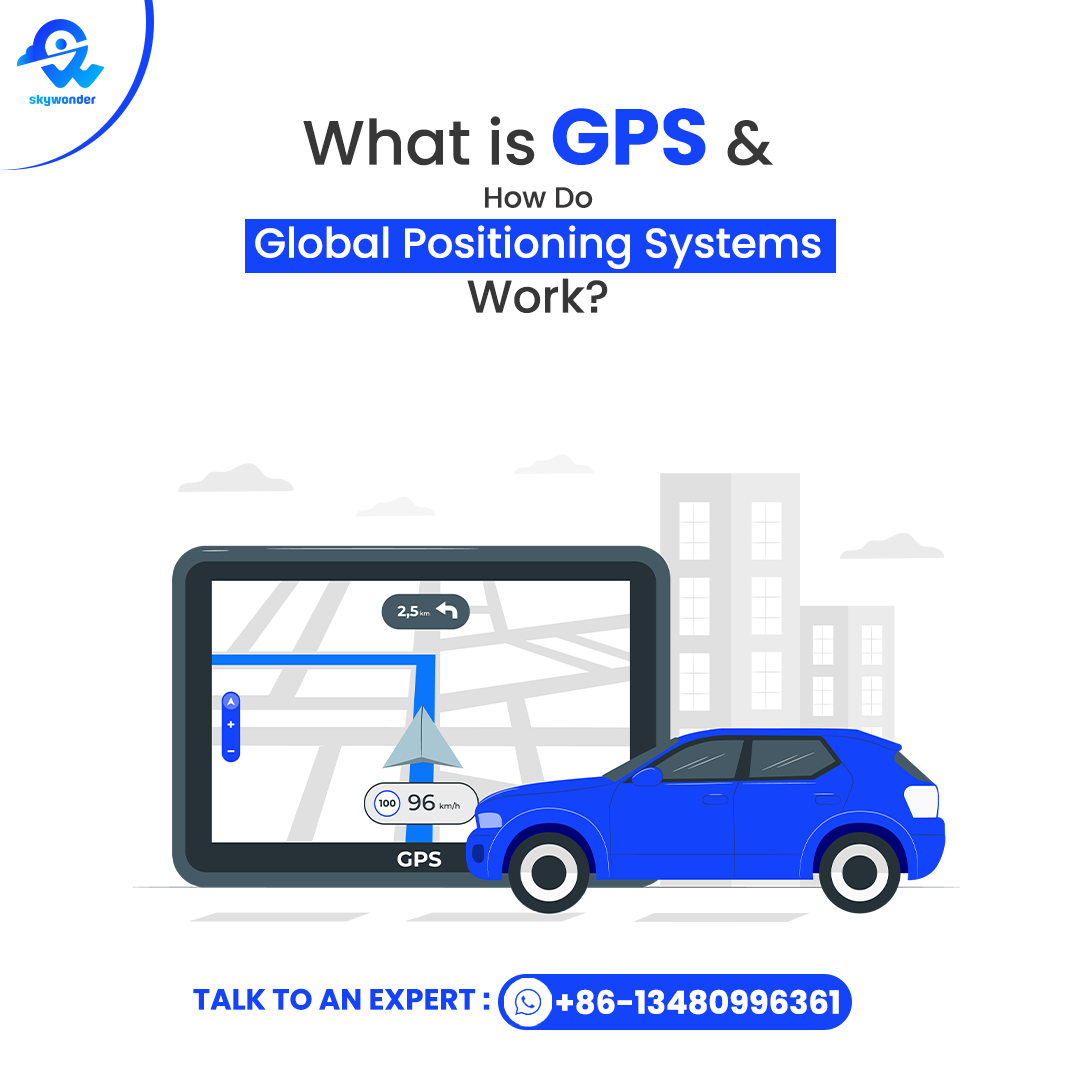
What Is GPS and How Do Global Positioning Systems Work?
Ever wondered how your phone knew where it was? Or how does a map application navigate a location without losing its way? Well, the solution lies in Global Positioning Systems (GPS). GPS technology enables us to navigate, monitor movement, and locate ourselves. But why was there GPS, and how did it function? Let’s discover the technology for you in simple words!
What is GPS?
The Global Positioning System is a US government-operated satellite radio navigation system, which is owned by the United States government and operated by the United States Space Force. Essentially, the GPS function provides three-dimensional position (latitude, longitude, and height) and accurate time information for properly equipped receivers on Earth’s surface or near Earth.
Unique characteristics of GPS:
- Global coverage: Works in any weather conditions, globally
- 24-hour operation: Opens and closes 24/7 with no holdup
- Timing accuracy: Space satellite atomic clocks with nanosecond accuracy
- No subscription or direct charge
The GPS space satellite system is in orbit at 12,550 miles above the Earth
The Three Segments of Global Positioning Systems(GPS)

GPS contains three distinct segments integrated:
1) Space Segment: Satellite constellation
- 24-32 working satellites (31 working satellites)
- In six planes of orbits, with four on a plane
- Orbit altitude: 20,180 km
- Orbital period: 11 hours 58 minutes
2) Control Segment: Monitoring on the ground
- 1 Master Control Station (Schriever SFB, Colorado)
- 11 ground monitoring stations globally
- 4 satellite-ground antennas for communication
3) User Segment: GPS receivers
- Equipment used by both civilians and the military
- Used in cell phones, cars, airplanes, and boats
How Do Global Positioning Systems Work?
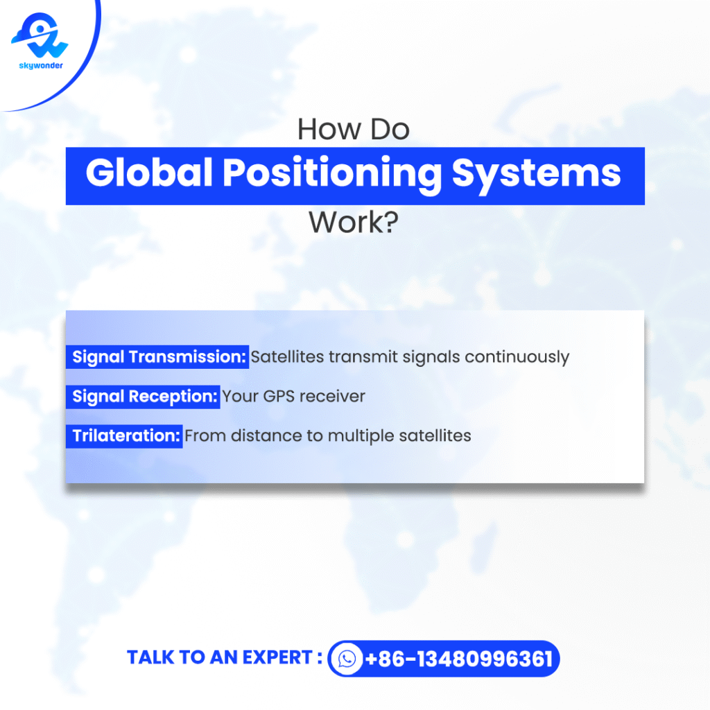
How does GPS work at a fundamental level? The system is based on principles of primitive physics and sophisticated math:
1) Signal Transmission: Satellites transmit signals continuously
- Its accurate location in orbit (ephemeris data)
- System time from its atomic clock
- Almanac information for all satellites
2) Signal Reception: Your GPS receiver:
- Compares three or more satellite signals
- Measures signal travel time (light speed × time)
- Calculates the distance to each satellite
3) Trilateration: From distance to multiple satellites
- 3 satellites provide 2D position (latitude/longitude)
- 4+ satellites provide 3D position (and altitude)
- More satellites make it more precise on which
Which Method or Tool Is Used in GPS to Pinpoint a Location?
The mathematical process is called trilateration mathematically – the calculation of the position by measuring the known position. Triangulation reverse (angles). What is GPS and how does it work? Let’s track the process:
- First Satellite: Positions you at some location on a sphere of potential points
- Second Satellite: Refines to two overlapping spheres at a point
- Third Satellite: Refines possibilities to two points (one typically in space)
- Fourth Satellite: Provides accurate 3D position and compensates for timing errors
How Accurate Is GPS?
Standard GPS Accuracy
- Smartphones: 3-5 meters open.
- Car navigation: ~ 3 meters under the best reception.
- Commercial GPS devices: 1 to 3 meters (3 to 10 feet) with WAAS/EGNOS correction
High-Precision GPS (GNSS) Accuracy
| System | Precision (open sky) | Best Use Case |
| Basic GPS | 3–5 meters | Normal navigation |
| GPS + GLONASS | 2 –3 meters | Improved in jungles and urban areas |
| GPS + Galileo | 1–2 meters | Research, precision agriculture |
| GPS RTK/PPP | 1–3 cm | Autonomous cars, drones |
Factors That Influenced the Accuracy of GPS
- Clear Sky View: The greater the number of satellites, the greater the accuracy.
- Urban Canyons: High buildings spoil the signals, accuracy falls to 10–20 meters.
- Weather: Solar storms or rain storms can interfere.
- Signal Jamming: Not applicable in military GPS.
Future Improvements
- GPS III satellites: 1 meter public accuracy.
- Multi-GNS receptors: GPS + Galileo + Beidou for better urban tracking.
- AI corrections: Smart algorithms if self-coordination in real time.
What Are the Uses of GPS?
1. Navigation and transportation
- Road Navigation: GPS Powers Applications such as Google Maps, Waze, and Car Navigation.
- Aviation: GPS guides the pilots for safe takeoff, landing, and air navigation.
- Marítimo: The GPS guides the ships to sail safely around the ocean, arrival in the port, and prevents collision.
- PUBLIC TRANSPORT: Trains and buses use general clinicians to show the time and place in real time.
2. Emergency and safety services
- 911 and Emergency Response: GPS helps 911 callers determine their location.
- Research and Rescue: Helicopters and drones apply GPS to find lost walkers or disaster survivors.
- Disaster Management: Routing Rockets, Earthquakes, and Floods for Evacuations.
3. Agriculture and Agriculture
- Precision Farming: GPS tractors sow seeds and fertilizers at an inch precision.
- Livestock Tracking: Farmers track cattle movement using GPS collars.
- Soil Mapping: GPS drones trace soil to maximize crop yield. This is a marvelous achievement of technology that has propelled such proficiency to dizzying heights.
4. Defense and military
- Missile orientation: GPS is used for accurate puncture strikes with less collateral damage.
- Troop Tracking: Armed Forces use encrypted GPS for real-time battlefield coordination.
- Drone operations: UAVs use GPS for recognition and strike.
5. Science and Research
- Climatic Studies: GPS tracks the glacial and sea level movement.
- Wildlife Conservation: Scientists accompany endangered animals with GPS necklaces.
- Archaeology: GPS locates old ruins to the centimeter.
6. Daily consumer uses
- Smartphones and Wearables: GPS is used by Fitbit activity monitors to find running paths.
- Tour sharing: GPS is used by Uber and Lyft drivers to find pilots.
- Geocaching: An Outdoor treasure hunt with GPS.
7. Industry and Logistics
- Fleet Management: Companies trace delivery trucks for efficiency.
- Construction: Excavators and accurate excavators.
- Mining: Non-manned mining trucks guided by precision travel without risking lives.
Who Uses GPS? From Children to Astronauts
The GPS output device market has expanded dramatically:
Consumer Applications
- Smartphones: 6.8 billion GNSS-capable phones in the world
- Wearables: child/pet tracking, fitness tracking
- Recreation: geocaching software, golf range finders
Industrial Users
| Industry | Principal Applications | Benefit |
| Aviation | ADS-B, navigation | 10% fuel saving |
| Shipping | Container tracking | 35% customs clearance improvement |
| Mining | Autonomous haul trucks | 15% productivity increase |
| Surveying | Cadastral mapping | Centimeter-level precision |
Government and Military
- Defense: Troop location, guided munition
- Scientific: Seismic detection, climate monitoring
- Infrastructure: Syncing of telecom networks, sync of power grids
What is GNSS? Understanding Global Navigation Satellite Systems
GNSS stands for Global Navigation Satellite System – a networked system of satellites providing positioning, navigation, and timing (PNT) service worldwide. GPS is the predominant system (US-owned), but GNSS includes all other nations’ satellite nav systems, such as:
- GPS (USA)
- GLONASS (Russia)
- Galileo (European Union)
- BeiDou (China)
GPS vs GNSS – Understanding the Ecosystem
While “GPS” is commonly used generically, it’s actually one of several global positioning systems:
| System | Operator | Satellites | Accuracy | Special Features |
| GPS | USA | 31 | 3–5 m | Optimal worldwide coverage |
| GLONASS | Russia | 24 | 5–10 m | Enhanced high-latitude performance |
| Galileo | EU | 26 | 1 m | Optimal civilian accuracy |
| BeiDou | China | 35 | 1–3 m | Asian-Pacific emphasis |
New receivers will employ multiple constellations integrated to be more robust, especially in harsh environments like city canyons.
The Remarkable Applications of GPS
Transportation Revolution
What are the uses of GPS in getting people and goods from place to place?
- Aviation: GPS enables:
- Accurate approaches in bad weather
- Reduced airplane spacing
- Automatic dependent surveillance (ADS-B)
- Maritime: GPS uses on boats are:
- Prevention of collisions
- Automated docking system
- Search and rescue operations
- Automotive: GPS is utilized by new vehicles for:
- Turn-by-turn navigation
- Emergency crash notification
- Usage-based insurance policies
Scientific Research Applications
GPS is crucial for scientists today:
- Geodesy: Tectonic plate motion measurement (to mm/year)
- Meteorology: GPS radio occultation weather prediction
- Biology: Animal migration tracking
- Archaeology: Accurate determination of archaeological sites location
Precision Agriculture
GPS in current agriculture for:
- Auto-steer tractors (2 cm precision)
- Precision seed/fertilizer application
- Monitoring yield for mapping productivity by field
- Soil sample location accuracy
Emergency Services and Public Safety
The function of GPS in protecting lives:
- E911: Automatic emergency call dispatching
- Location tracking of emergency personnel in emergency situations
- Amber Alerts: High-speed radio broadcasting of child abduction information
- Avalanche beacons: Excavating survivors buried beneath the snow
The Evolution of GPS Technology
Historical Timeline
- 1957: Sputnik launch indicates the ability to monitor a satellite
- 1960s: U.S. Navy used the TRANSIT satellite system
- 1973: DOD initiates NAVSTAR GPS program
- 1978: First Block I GPS satellite put in orbit
- 1983: Access by civilians was provided after the crash of Korean Air Lines
- 1995: Announced Full Operational Capability
- 2000: Selective Availability turned off (accuracy increased 10x)
- 2005: The First GPS IIR-M satellite modernized was launched
- 2010: First GPS III satellite became activated
- 2018: GPS III began launching with new signals
- 2023: AI -moved GPS optimization helps reduce urban signal errors.
- 2025: Quantum navigation is tested, potentially revolutionizing GPS beyond satellites.
The Future of Positioning Technology
New technologies that will free navigation:
- Low Earth Orbit (LEO) Breakthroughs
- SpaceX’s Starlink is illustrated for positioning
- Potentially up to 10 times more accurate than existing GPS
- Quantum Positioning Systems
- With atomic interferometry
- Already demonstrated possible indoors and underground
- Lunar GPS:
- New NASA navigation system for the moon
- Essential to Artemis program missions
- 5G + GNSS Hybrid Positioning
- Combines 5G towers + GPS/Galileo signals
- Eliminates “urban canyon” GPS drift
- Key for autonomous cars & AR navigation
- AI-Optimized Real-Time Corrections
- AI predicts and adjusts for signal delays & blockages
- Crowdsourced data improves global accuracy
- Makes phone navigation as precise as survey-grade GPS
Conclusion: The Ubiquitous Utility of GPS
Before us are enhanced global positioning systems that are more accurate, more reliable, and more accessible.Already aware now of what is gps and how does it works, you’ll never look over at that tiny little blue dot quite the same ever again!